“What a glorious greeting the sun gives the mountains.”
John Muir
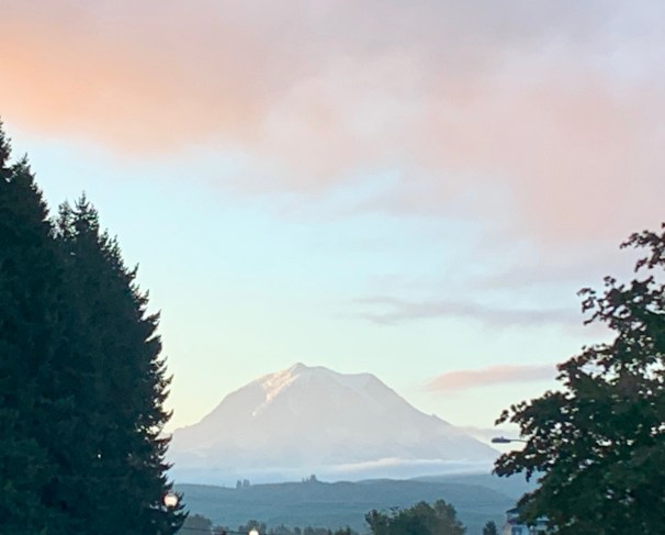
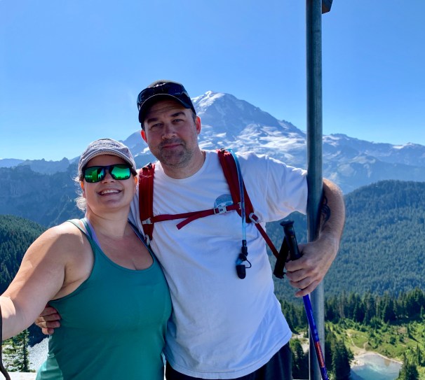
Labor Day weekend we finally made it [back] to Tolmie Peak. This hike is one of my all-time favorites, for several reasons. For one, it’s a workout. It is also beautiful, every step of the way. The first time I went, the clouds and fog were all around us and we almost didn’t get our big payoff. (We did, but that’s another story.) This weekend, from the moment we walked out the door, I knew we were going to have the most amazing hike ever, because, truly, when this is what you see as you’re leaving your house, how can it be anything but a fabulous day?!
While this was my second time going to Tolmie, it was my fiance and our friends first time, and I was so excited that they were going to have the best possible experience I could hardly sit still! Some important notes about Tolmie: It is only open from around June/July until October because the roads close down due to the amount of snow they get. And let me tell you, waiting for word that Mowich Lake Road is open is excruciating some years. (This year it didn’t open until late July!) Also, you leave the paved road behind when heading to Tolmie Peak, and it is 16 miles of bumpy, dusty, dirty road between Wilkinson/Carbonado and Mowich Lake.
WHAT YOU NEED:
* High clearance vehicle and/or 4WD;
* America the Beautiful Pass (or pay the $20 fee -cash only- at the pay station a couple miles before Mowich Lake/Tolmie Peak trailhead);
* Good hiking boots;
* WATER;
* Hiking poles recommended. At least by me and my fiance. He has bad knees and I’ve found they help me climb the “stairs” that are sometimes, actually, giant rocks taller than me.
Don’t get me wrong, the views along the way are beautiful, but you’re going to feel allllll 16 miles of that road! There are some side turnouts, such as the Evans Creek ORV Park (a great place to take your dirt bikes, ATV’s and Jeeps) but you want to stay on the main road all the way up. You also get to cross over the bridge in Carbonado, which is only one lane, so you have to take turns with cars on the other side. Make sure you slow down, as there will be pedestrians walking across, as well, for pictures and to get to the trail located below said bridge. (That’s called the Melmont Ghost Town Trail but that’s another post. 😉 )
There will be a “ranger station” on the right hand side of the trail, where you’ll have to stop and pay your $20 fee to continue on your way to Mowich Lake and everything around it. I say “ranger station” because it’s a billboard, with a pay box, and a bathroom. Easy to pass by without realizing what it is , if you’re not careful. If you have the America the Beautiful Pass, you don’t have to pay this day use fee and can keep on driving. And, of course, you can tempt fate and turn your nose up at the pay station, but the Rangers ARE out, they do look for your passes on cars, and they will ticket you if you don’t have one. (We know because we saw it happening.) So, proceed at your own risk here. We highly recommend the America the Beautiful pass because it gets you into all the other parts of Mt. Rainier (soooo many hikes) as well as every other National Park in the U.S. Well worth the money if you’re an avid hiker/traveler.
If you’ve never been through here, pause for the photo op. It’s gorgeous looking down at the water from the middle of the bridge and you won’t be sorry you stopped. There are several spots along the way where you’ll see people pulled over- it’s either photos, bathroom breaks or because they’re getting ready to do some 4x’ing once you’re out of the way. I recommend stopping at some of these spots, too, because the views are just breathtaking!


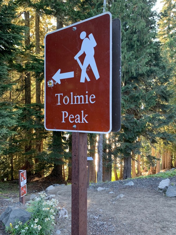
Once you get to the top of the hill that is this road, (you’ll know you’re there because you’ll start seeing a line of cars parked on the left side of the road) you’ll want to grab a parking spot at the end (or beginning? Depending on how you look at it) of that line of cars. The Tolmie Peak trail head is on the left side at the first sharp right hand turn at the top of the road. Again, you’ll know where that is because of all the cars parked there. The earlier you arrive the better the chances you have of getting close to the trail head. We timed our arrival for about 8:30 a.m. (which is a little later than we usually start, but it was a holiday weekend and we were all a little tired). This worked great for us, but there are a lot of people who go up for the sunrise views, so don’t expect to have this trail to yourself, pretty much ever, and understand that the later you go, the more people you’ll be sharing it with. We actually discussed giving the sunrise hike a try next time, too; we’ll see how that goes because, without a doubt, you’ll need a good headlamp and none of us have one of those yet!
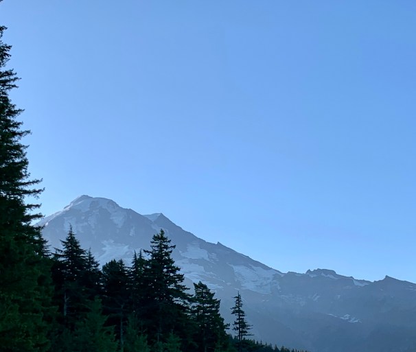
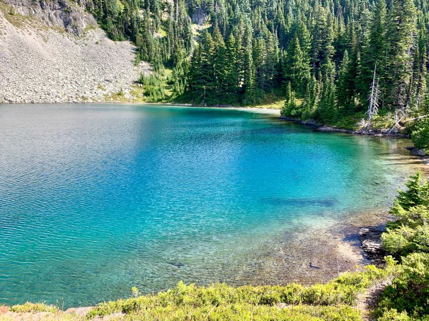
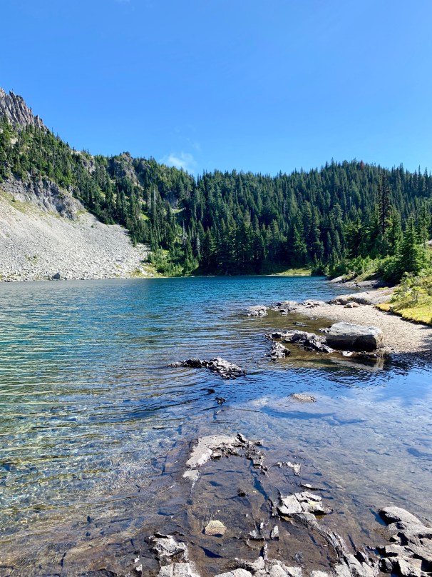
Side note: If you keep following the road about another .25 miles, you’ll come to a “parking lot” and the trail head for Mowich Lake, Mowich Lake Campground, Spray Park Falls and, perhaps most important, the only “restroom” with a door in the area. I highly recommend checking out Mowich Lake, because it’s gorgeous and a favorite for kayakers, but I will let you know that you’ll get some views of it at the beginning of the Tolmie Peak trail, as well. These peeks don’t do it justice, though, so make sure you take a moment, either before or after the hike, to pause and take in all that is Mowich Lake.


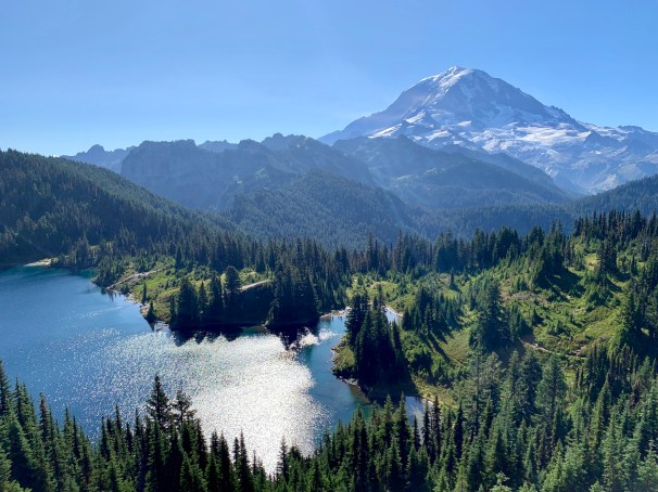
Water so blue you can tell it comes from the glaciers up above you…
Back to the trail… this hike is roughly 5.6 miles long, round trip, with an elevation gain of 1,522 ft. There is one side trip, to Ipsut Pass, about a mile down the trail, that is only as long as you want to make it, but does give you yet another beautiful view and is worth the quick jaunt. Please note: This path leads to another trail- and yet another trail- but you only have to go 200 ft off the main trail for this:
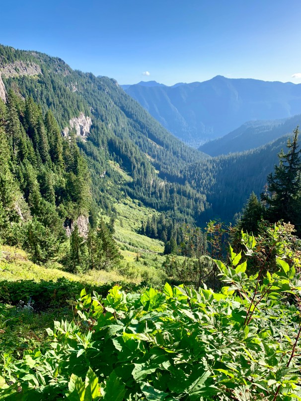
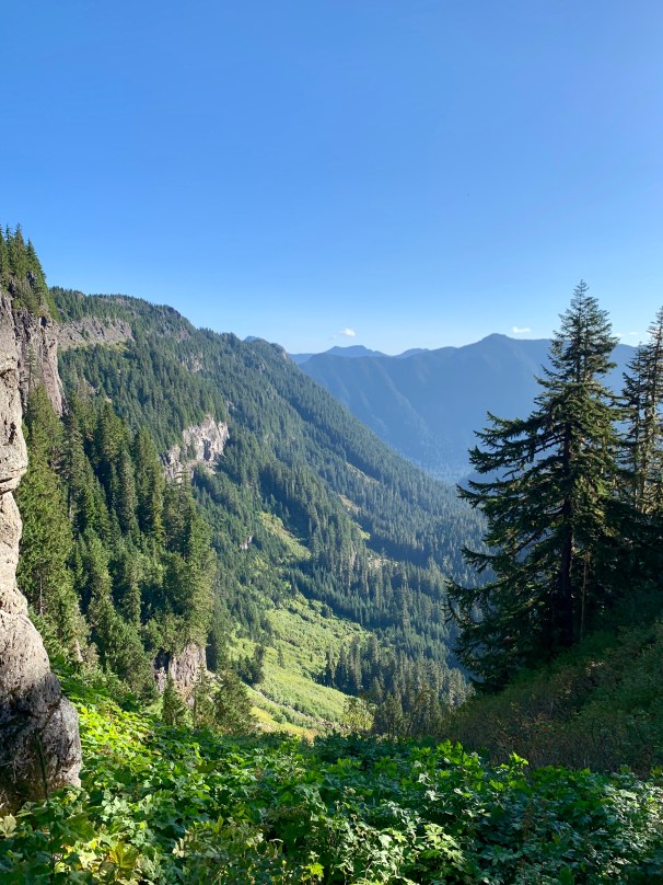
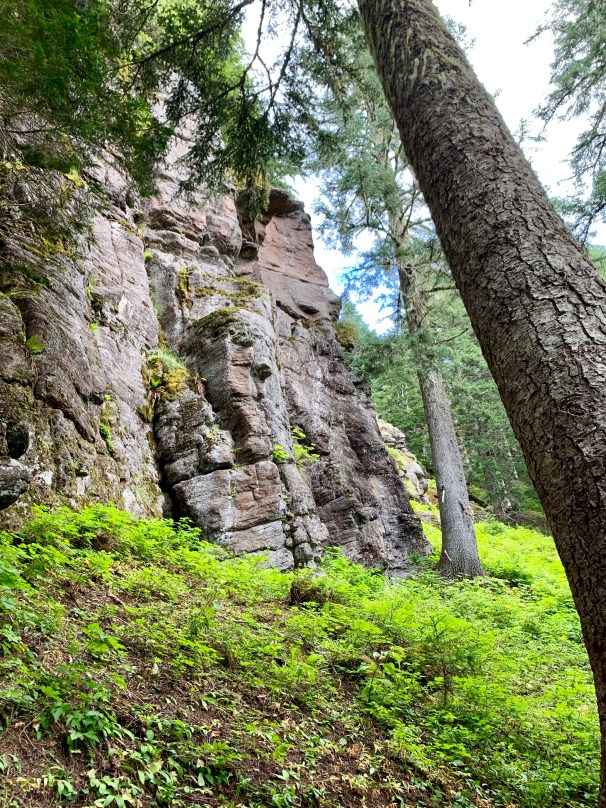
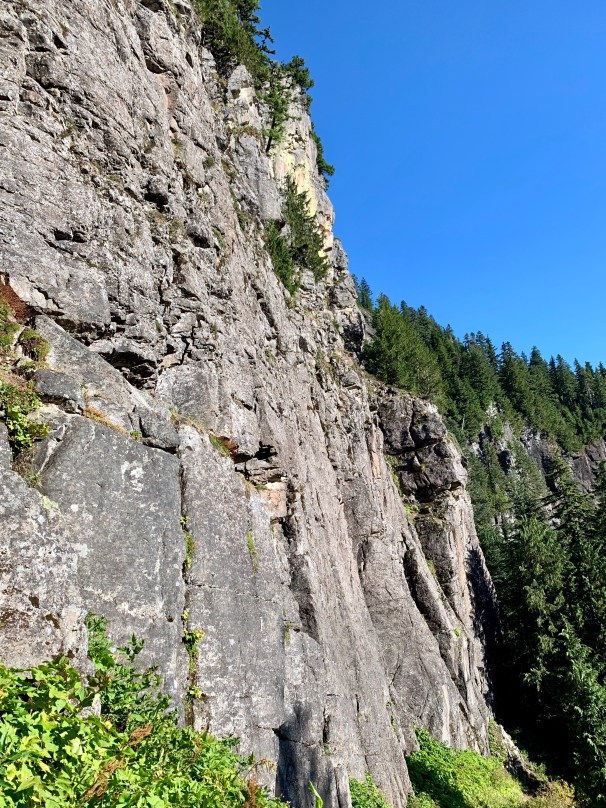
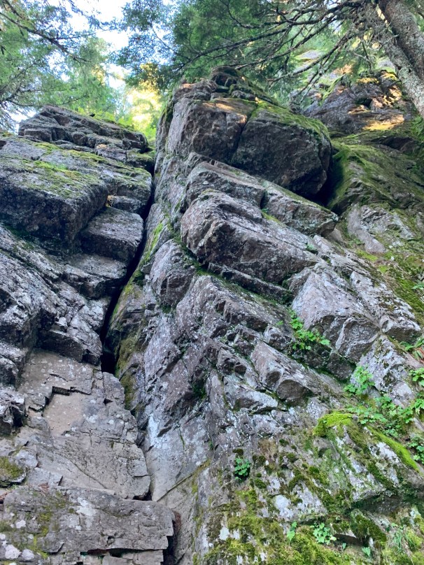
Some of my favorite things along this hike: The rock cliffs that you walk alongside, on and off, for the first half of the hike, the flowers, and Eunice Lake. Without a doubt the entire point of this hike is the view from the top, but the beauty that greets you at every turn along the way must be admired and expounded upon, as well! The first time I did this hike, I also had the pleasure of watching a mamma deer and her fawn snacking, quite literally, a feet away from me. This time we only had chipmunks and birds for accompaniment, but they were a delight, too.


Also, this time, I was quite amazed by how many different kinds of mushrooms we came upon. Before you get the wrong idea, no, I am not a mushroom fan- legal, illegal, regular, expensive or hallucinatory! But weirdly shaped mushrooms definitely catch my attention- especially ones that make us think of hamburgers! I only took pictures of two of them, but there were quite a few others.
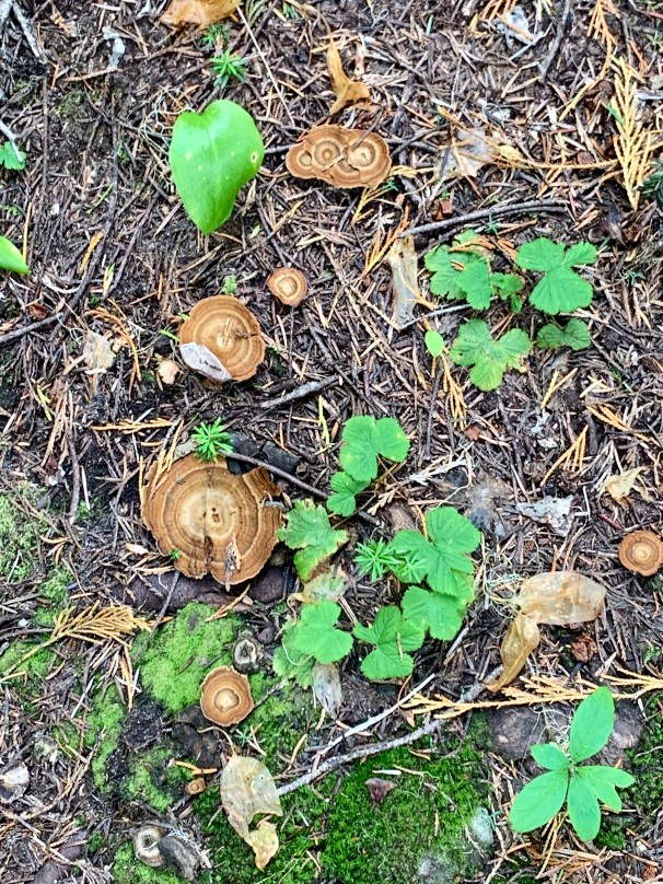

I wasn’t the only one singing about sesame seed buns 
Now for some honesty- the things that I both love and hate about this hike: the stairs, the altitude climb, the up and down that sometimes never seems to end. That being said, for me, without a doubt, the payoff this hike gives is worth every agonizing minute! I am not going to claim to be in the best of shape right now; I’m definitely a little on the less at this moment in time, but even I can do this hike with a minimal amount of whining! 😉 This, however, does not mean that I do not spend my fair share of time dreaming about reaching the top, at last, and sitting down with my well-deserved lunch!


Perhaps because I’m a glutton for punishment, or simply stubborn and perverse, but as I stated above, I love this hike for all the reasons I hate it. I love the way it kicks my butt, I love that it makes me work for it, and I love that I feel so alive when I get to the top, and so tired when I get back to the car! Add the views and for me this is a four-star hike! And considering this hike doesn’t even have a waterfall, that is extremely high praise, indeed!
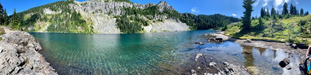
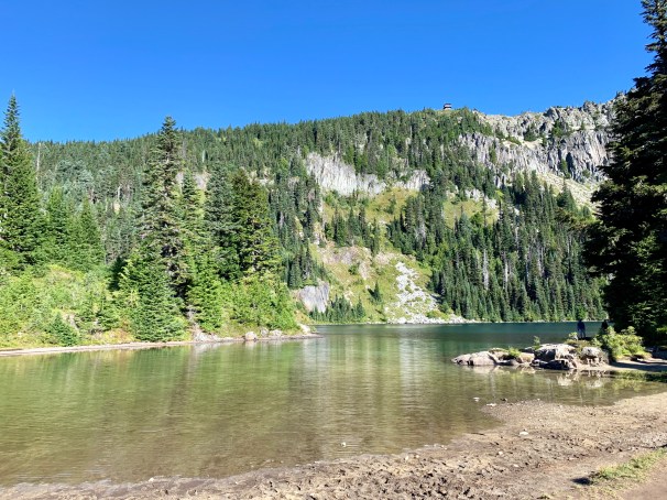
The next stopping point on this journey is Eunice Lake, about 2 miles from the trailhead at Mowich Lake, and something that you think you are appreciating while standing there, but will soon realize you had no real idea just how beautiful it is, truly. My fiance and I are both recent fans of kayaking. We’ve had our own kayaks for a little over a year now, and thoroughly enjoy the sport. We even had big plans on bringing our kayaks up to Mowich Lake and taking a spin around after we finished Tolmie Peak, but we didn’t manage to get ourselves organized enough to make it happen, much to our chagrin.
Why am I telling you this, you may ask? Because the first thing we both thought as we stood there gazing out over Eunice Lake that morning was: “I would LOVE to kayak this lake!!” This was immediately followed by: “But we’d have to move here because there is no way I’d be carrying that kayak up AND down this mountain!” Clearly we are “fair-weather” kayakers! 😉
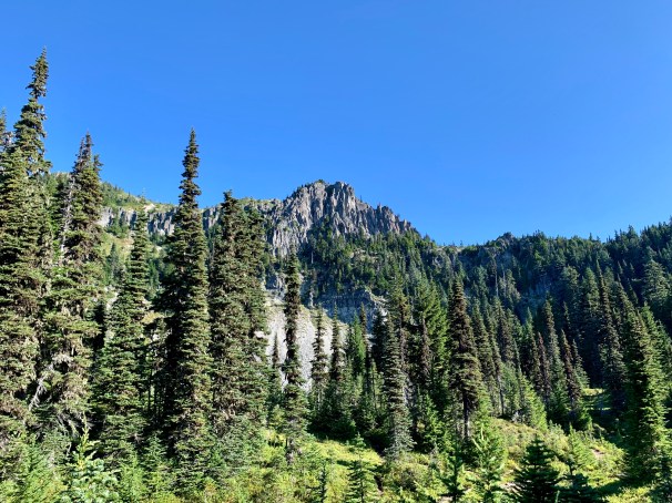
As you stand here gazing at the lake, and your surroundings, you will eventually find your gaze drawn up to the fire lookout at the top of the opposite hill. Funny story: the first time I did this hike I did not plan it, and therefore did not do my usual research. I went with a friend, and I let her take the lead. Her daughter, who had not gone on many hikes at that point, was tired and just about done. As we stood there, looking around, she exclaimed: “Are we hiking up to there?!” in a voice laced with pure horror. Clueless me looked up, guffawed and replied, ‘Oh no! That’s on another mountain!” with absolute conviction in my voice. My friend stayed quiet, but as we turned to continue along the trail, she murmured to me, “I’m pretty sure that’s where we’re going!” In all honesty, I was just as appalled as her daughter, for a moment there! Ha!


Look hard- the fire lookout is waaay up there!
Now that I’ve shared this story with you, I have another confession to make. I took great delight in pointing out that same lookout to my fiance and our friend, and stating, with a rather gleeful grin on my face: “That’s where we’re going.” The looks on their faces made me feel much better about my first reaction, I can assure you!
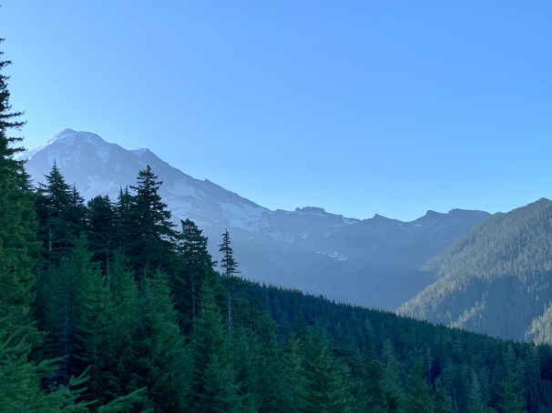
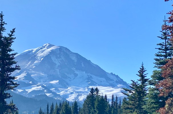
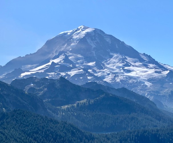
The rest of the hike consists of a rather steep, switchback-laced climb to said fire lookout, but oh the views! I cannot find the words to describe the beauty that surrounds and assails you as you make that last push to the top; the immense expanse of blue and green (and every color in between) that greets you at every turn is jaw-droppingly gorgeous and left us far more breathless than the exertion and altitude. I am so eager to share my pictures with you, but please believe me, they do not even begin to do this part of the trail justice!


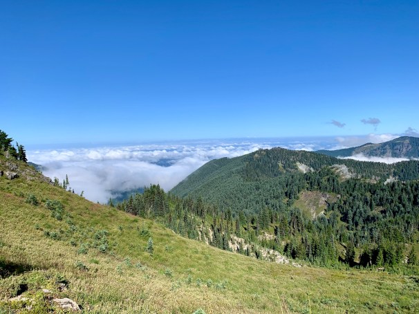
As you get to the “almost” top, there is a little clearing, and from there you can suddenly see the other side of this mountain you’ve been climbing! While not quite as grand as the view you’ve had for the last .75 of a mile, it is still quite pretty and we had fun trying to figure out which towns we were “seeing”. My fiance was probably the closest, and he was mostly guessing, but he was pretty sure we were looking out over the Orting/Puyallup Valley.


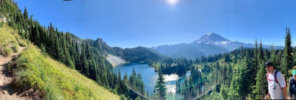
panoramic view
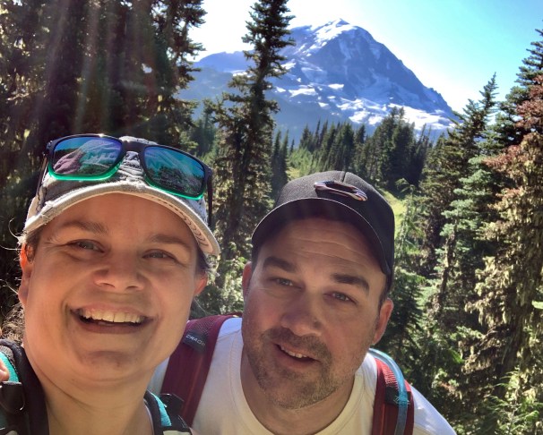
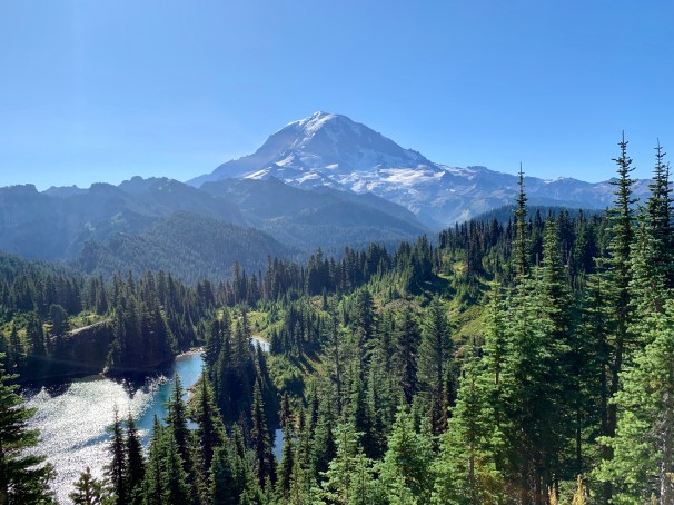
And now for the part we were all waiting for: Tolmie Peak, as seen from the now infamous fire lookout. Tip: You can climb up to the deck of the lookout to eat your hard-earned lunch. You can also keep walking along the ridge, if you so desire. Each time I’ve gone I’ve said, “Next time.” And so it goes, but we’ve seen lots of people venture on and it looks like fun! The view is everything you’ve heard, and more, and what makes all the effort worth it.


If you hurry, you can still make it before the road closes for winter, but time it well- you want a bright, clear day…
“Don’t climb mountains so that people can see you. Climb mountains so that you can see the world.”
David McCullough, Jr.
